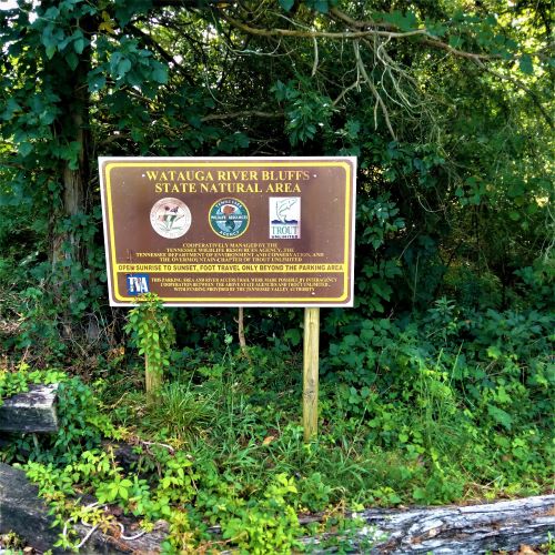
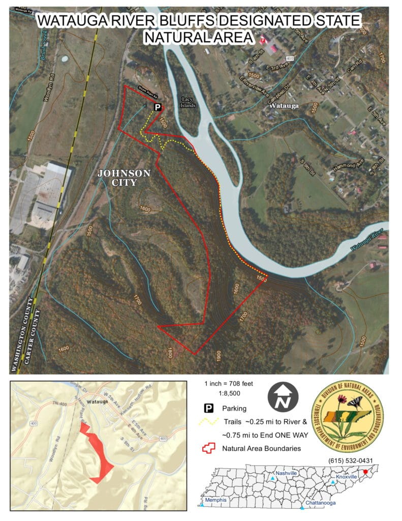
The Watauga River Bluffs State Natural Area is a 50-acre, rugged reserve open to the public in Carter County, Tennessee.
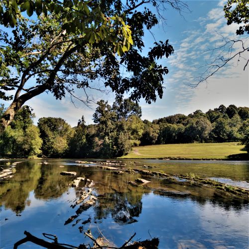
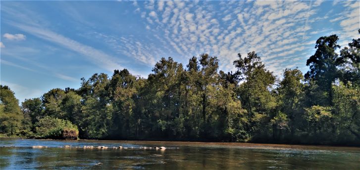
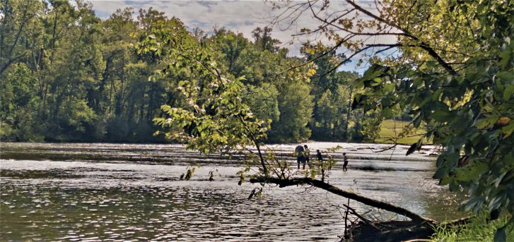
With a few thousand feet of river frontage, the Watauga River Bluffs offers fishing within the “trophy” section of the river, a hiking trail along the river’s edge and general splashing in the water.
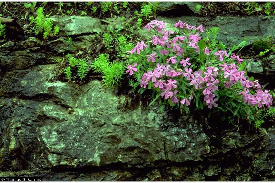
Protecting the Carolina Pink
Undeveloped and unoccupied since the ‘50s, this natural area is managed by the State of Tennessee. In 1993, General Shale sold the property to The Nature Conservancy. Five years later, the nonprofit transferred the property to the state.
The property was purchased to protect the state-listed Carolina pink (Silene caroliniana).
Bordering an old General Shale mine, the bluffs drop more than 200 feet to the riverbank. It is home to the largest-known population of the Carolina pink.
The Carolina Pink blooms in April, May and June and likes a moist, partly shady environment and well-drained rocky soil. Sounds kind of like the bluffs.
Inside the bluffs, the flower is “mostly concentrated in an open dry chestnut oak forest occurring on the west-to south-facing upper slopes” of the state natural area, according to a Tennessee Department of Environment & Conservation info page.
Shale Cliffs and Diverse Plants
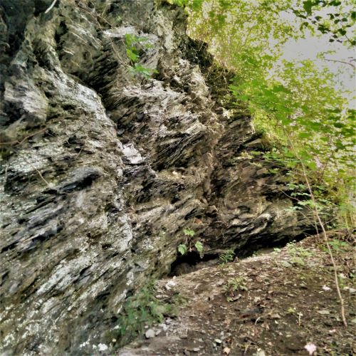
Looking up the mountainside, the slopes are fragile.
When hiking the area, I saw brittle cliffs of shale and its crumbly chips on the ground nearby. Over time, these shale fragments slide down the mountainside, resulting in shale debris on the canopy floor.
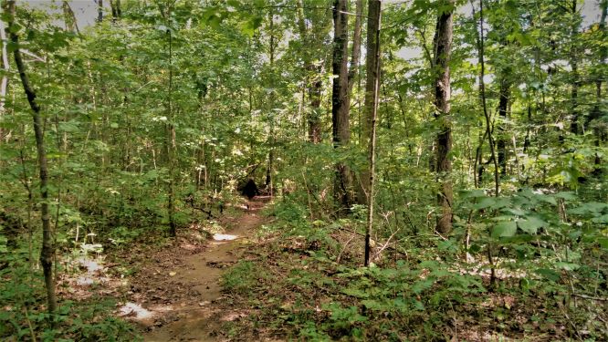
Walking the ¾ miles of trail along the riverbank and lower slopes of the bluffs, you will see plenty of wildflowers and ferns like Jacobs ladder, hepatica, trout lily, spring beauties and trilliums – depending on the season, of course.
Described as having a “rugged landscape harboring a diverse plant community,” the natural area includes white ash, bitternut hickory, eastern red cedar, chestnut oak, white oak, eastern hemlock, tulip poplar and yellow buckeye trees.
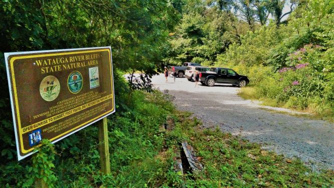
Watauga River Bluffs Access Trail
In 2015, an access trail to the Watauga River opened and a small parking area built. A picnic table exists near the riverbank and two benches are located at the trail head. The parking area accommodates about 8 vehicles.
This access project was made possible by the Division of Natural Areas, Tennessee Wildlife Resources Agency, which patrols the area, the Tennessee Valley Authority, which operates the Wilbur Dam upstream, and the Overmountain Chapter of Trout Unlimited (OMTU).
The trailhead is located at the parking area. The trek to the river is about ¼ mile of easy hiking through a wooded area. The trail parallels the river for another ¾ of a mile.
In all, you could expect to hike 2 miles round-trip if exploring the entire trail. Note that close to half of the trail along the river frontage is cut short whenever the TVA’s Wilbur Dam is generating upstream. More on that below.
Sponsored by Overmountain Chapter of Trout Unlimited
Appalachian Paddling Enthusiasts Help Kayak Trash Out

This area is sponsored by the Overmountain Chapter of Trout Unlimited.
When it opened to the public in 2015, the group installed the entrance sign for the access. The OMTU meets a couple times a year to maintain the trail and sponsor cleanup days. They pick up trash that washes ashore. Also, they remove brush, fallen trees and cut the grass along the parking area and trail.
During cleanup days, the OMTU will partner with the Appalachian Paddling Enthusiasts (APEs) to cleanup the these recreational areas. People on foot will walk the trail along the river, collecting the trash and litter, and fishing guides and kayakers will boat out the hefty haul.
Aside from cleaning up and maintaining the area, the OMTU also extended the trail by 1/3 of a mile in 2018.
Fishing the Trophy Section of the Bluffs
As for the fishing in the bluffs area, “It’s real good,” according to Ryan Turgeon, current president of the Overmountain Chapter of Trout Unlimited.
“That’s on the trophy section of Watauga River, and it’s the only public access on the trophy section of the Watauga River. The rest is all on private land,” Turgeon said. “It’s just a beautiful area down there.”
Asked for any suggestions when fishing in the bluffs area, Turgeon suggested folks be careful when wading. The riverbed in this area is pretty muck rock and those rocks can be slick.
“There are big flat rocks and they are sloped down in crevices. So the wading can be a little dangerous at times. Definitely don’t be wading if they are generating anything,” Turgeon said. “If they are not generating, just be careful. It helps to take a wading staff to keep your balance on some of those rocks.”
Aside for catching fish, Turgeon said, “Midges, size 20 or smaller, are usually the hot ticket down through there.”
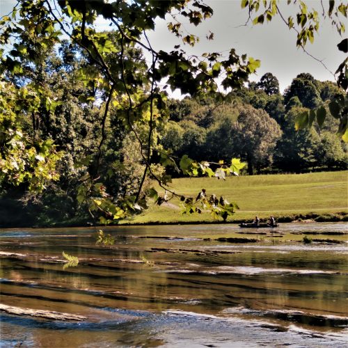
The river is about a 100-feet here. It is shallow on the near side bordering the state natural area. When hanging out in the bluffs, you will likely see drift boats with anglers floating by on the far side of the river, where a deep channel exists.
“If you can get out there and wade those spines of those rocks to the channel and fish, that channel is usually pretty good fishing,” Turgeon said.
In summary, the Watauga River Bluffs trail is a great way to access the river by foot.
I wouldn’t go there strictly for the hiking – other than to explore it for the first time, view the seasonal wildflowers and vegetation or if I was walking a dog.
When hiking the area, I saw a local family with several kids splashing around in the water, enjoying the Watauga River. I also saw a small boat drift by with a couple fishermen, looking to catch some of the trophy-size trout that this river is famous for across the Southeast.
Because of the hike, this would not be a good place to put-in a kayak or drift boat. I mean, there would be better places to do that. This area is primarily used by anglers walking down to the river and fishing on the bank or wading in the river.
Access Details and Dam Release Warning
The bluffs area is open from sunrise to sunset. Because there are no trash cans, leave no trace is the rule. There was quite a bit of trash along the trail when I hiked, but that’s because this area happens to strain a bunch of trash from the river.
No camping or hunting is allowed.
The trail is cut short when the TVA releases water from the Wilbur Dam. I hiked the trail when the dam was generating and I turned around once I came upon the river rising upon a boulder on the trail.
Because the Tennessee Valley Authority’s Wilbur Dam is located upstream of the bluffs, the river rises rapidly whenever the TVA releases water from the dam for generation. Call the TVA for more info about the release schedule at 865-632-2264 or click to TVA site.
Directions to Watauga River Bluffs
The map below will get you close to the river access. The online maps seem to get confused once I got near Steam Plant Road. The only thing to note is to bear right when you come to a t-intersection in a neighborhood-like area near or along Steam Plant Road.
You will then cross railroad tracks and drive past a church. The small parking area will be on the right after a one-tenth of a mile, when you will see signs for Watauga River Bluffs.
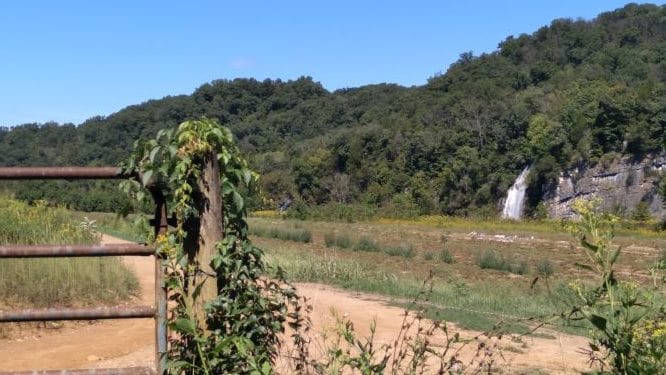
Once you turn onto Steam Plant Road look out for Quarry Falls in the distance. It’s actually a manmade waterfall as Blue Water Industries quarry discharges water into the Watauga River.
On Steam Plant Road, you’ll also see a property owned by former Capt. Thomas Gourley that is marked with a plaque. Gourley was given this property on the banks of the Watauga River when it was the frontier for his service during the American Revolution.
Trail Map of the Watauga River Bluffs
Fore more details about the Watauga River Bluffs State Natural Area, click to Tennessee’s Department of Environment and Conservation site or call the Division of Natural Areas East TN office at 865-594-5601.
For more adventures along the Watauga River in NC and TN, whether it’s in the river, lake or gorge, click to the homepage of On the Watauga.
More Images of Watauga River Bluffs