USGS Watauga River Gauge in Sugar Grove NC
The U.S. Geological Survey gauge in Sugar Grove is located immediately downstream of the Cove Creek confluence with the Watauga River.
Watauga River, Watauga Lake & Watauga Gorge
Water gauges for the Watauga River in NC and TN are useful for kayakers, rafters and even tubers to know whether a river is runnable and for anglers to know if waters are wadeable.
Gauges also provide real-time and historical data on periods of drought or times of flood.
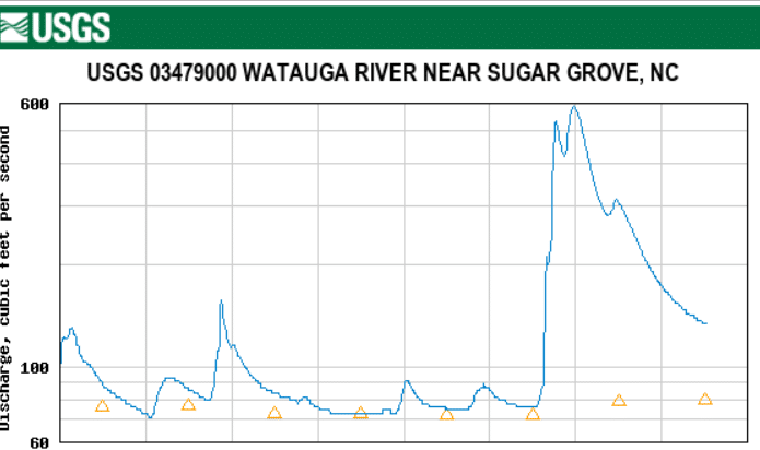
The U.S. Geological Survey gauge in Sugar Grove is located immediately downstream of the Cove Creek confluence with the Watauga River.
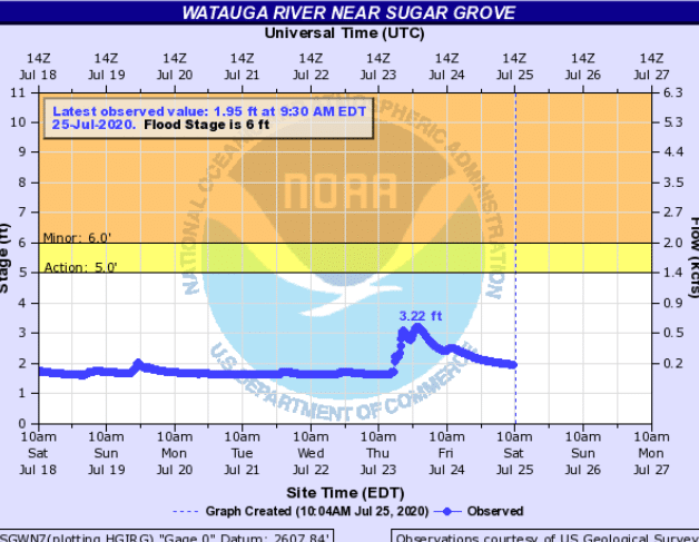
Quickly check what the Watauga River is running with the real-time gauges embedded below. The gauge sites are located in Foscoe and Sugar Grove, N.C., and Elizabethton, Tenn.
The N.C. Emergency Management operates a gauge upstream of the expert-only Red Roof kayaking run and old Hound Ears Dam on the Watauga River near Foscoe.