Profile Trail at Grandfather Mountain State Park Parallels River
The Profile Trail at Grandfather Mountain State Park is the most popular trail on the mountain.
For about 30 years, the Profile Trail began on the old Tweetsie Railroad grade and immediately crossed the Watauga River at the old trailhead and parking area. But like most of the natural gems in the High Country, popularity causes parking problems.
On a busy weekend, people used to park along the N.C. 105 shoulder 40 cars deep or in the The Pedalin’ Pig restaurant parking lot. Then, they had to sprint across the dangerous highway to get to the trail, former Supt. Sue McBean recounted to me in the past.
Today, the new Profile Trail access is located just 0.3 miles south of the former trailhead. It features a parking lot for more than 100 cars and restroom facilities.
(But even with the new parking lot, more people want to experience the area than space can accommodate for vehicles. On a busy weekend, the park fills up by noon, Grandfather Mountain State Park Ranger Luke Appling said. He recommends arriving by 10 a.m. to guarantee a parking space on holidays or good-weather weekends.)
The trail was extended to connect the new parking lot and older trail just near the old crossing over the Watauga River. When you hike the new trail and come to the river, you can see the old crossing and some of the path of old Tweetsie.
Headwaters of the Watauga River on Profile Trail
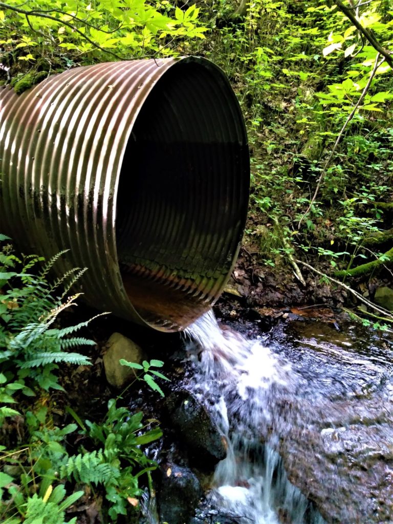
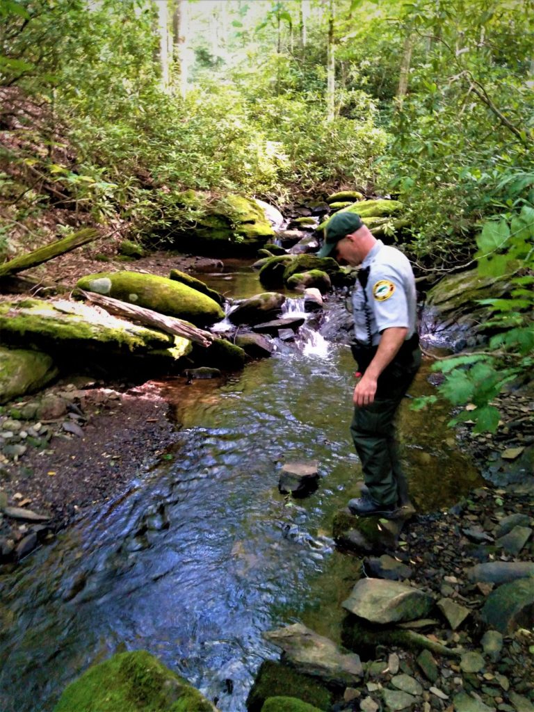
The headwaters of the Watauga River start behind that BBQ restaurant as a spring. Several unnamed streams converge just south of the new entrance to the Profile Trail off of N.C. 105, according to Appling.
Appling said that the maps he’s looked at show the Watauga River starting near the waterwheel beside The Pedalin’ Pig. There the beginnings of the Watauga River have been dammed up to create a small pond.
“That’s it. At least that’s what the maps show,” Appling said.
He was speaking to me while we were both standing across the street from the restaurant, on park property near N.C. 105.
“In reality, 4 little creeks come together. One that flows under the parking lot for Lowe’s [Food], two that come down from [Grandfather Mountain State Park property] and one that comes from under [N.C. 105] and they all come together right here,” he said.
“Someone, somewhere decided that the one that shoots over from there is the Watauga,” Appling said, pointing toward the waterwheel and restaurant.
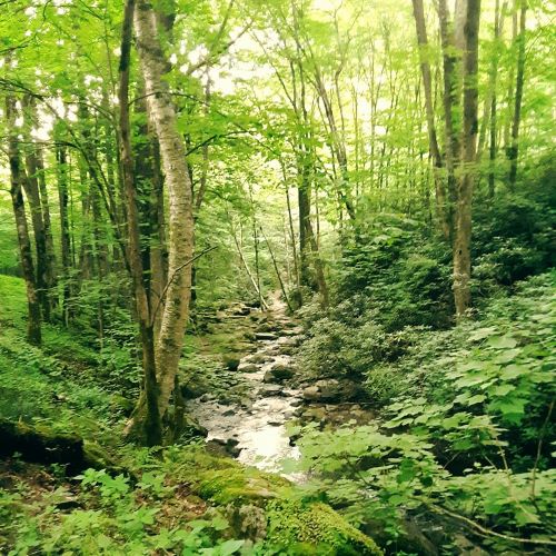
Profile Trail Offers Riverside Stroll before Trek up the Mountain
The Watauga River borders the park property for about another 0.8 miles, and the Profile Trail parallels the Watauga River for about 100 yards. Appling noted these figures are based on crude GIS tool estimates.
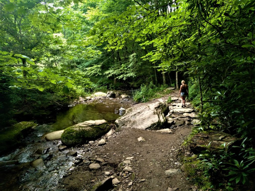
After about 0.5 mile hike from the trailhead, the Profile Trail begins to parallel the Watauga River. This is about where the beginning of the trail used to cross the Watauga River.
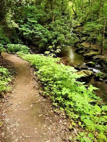
This stretch of the Profile Trail offers some creek hopping, shallow pools for younger kids, some tiny beachy areas and mini waterfalls. This is an excellent “primitive” river area for kids to enjoy the Watauga River and cool off in the summer months during a hiking day.
You can make it a nice 1-mile hike in to the river area and 1-mile hike out with younger kids. The beginning of the trail is wide and features rolling hills, wooden or rock steps for some inclines and a high bridge that my kids enjoyed running across.
Adventurous kids can definitely complete the entire Profile Trail, Appling noted.
With the headwaters nearby, the Watauga River at Grandfather Mountain State Park is smaller than say Valle Crucis and Sugar Grove, other popular areas along the river with public access, and much, much smaller than the Watauga River in Tennessee where anglers boat down the river to fish.
In all the Watauga River is 78.5 miles long and has several different personalities along that stretch.
Near Grandfather Mountain, the character of the Watauga River feels different with its forest canopy.
This is very unlike much of the pasture-land riverbanks in Valle Crucis and Sugar Grove or the giant boulder-studded sections along various parts of the river.
Also, the river has yet to carve out a steep canyon like you see downstream of the Guy Ford Road river access or the area near the Snake Pit rapids. And again, not wide open like in Tennessee beyond Watauga Lake.
As you are walking along the river or playing in the creek, you might come across some unique critters in the river. While you won’t find one of the giant Eastern Hellbenders as they need more water and bigger rocks to live under, you might find a Grandfather Crayfish.
“Never identified anywhere else [prior], it was first found here in the Watauga River,” Appling said. “They’ve since been found in the Linville. It shows this Tynecastle bog area, they are going back and forth between the two.”
Beyond the Profile Trail at Grandfather Mountain State Park
The riverside hike is a soothing start to a rather strenuous hike.
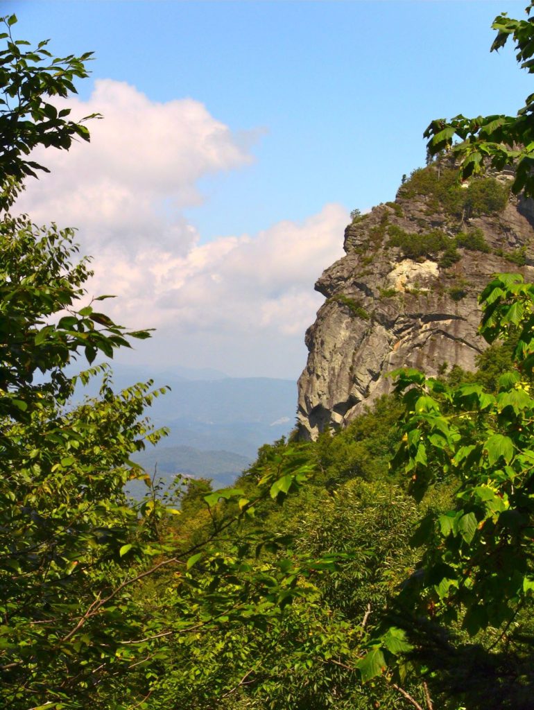
The Profile Trail is a 3.6 mile hike to Calloway Peak. The climb up is 1,775 feet in elevation, and the fruits of your labor are rewarded with a stunning view of the iconic face profile on the ridge of the mountain.
Randy Johnson, author of Grandfather Mountain: The History and Guide to an Appalachian Icon, was the Grandfather Mountain’s trail manager when the Profile Trail was built in the ‘80s.
Alluding to the early explorers visiting Grandfather Mountain more than 200 years ago such as French botanist Andre Michaux, Johnson said the most memorable thing about the Profile Trail is the view of the profile face.
“As I was working at Grandfather early on, I read the descriptions of what those early hikers and scientists were fascinated by and so much of what was discussed was the view of the profile face,” Johnson said. “That was the main goal for the Profile Trail.”
While the profile trail starts out like a stroll in nature, the upper sections of the trail get steeper at the 2 mile point near Foscoe View.
The following is from a description at Grandfather Mountain State Park’s website:
“Shanty Spring, at 3.2 miles, marks a transition into a strenuous pathway of tumble-down rock that joins the Grandfather Trail after a climb of 0.4 mile. It makes the transition out of the hardwoods and into the Canadian fir zone of the crest area. The upper section is steep and rocky and calls for careful footwork; this section is not recommended for pets.”
Backcountry Camping along Profile Trail and Greater Grandfather
The trail is part of a larger network of trails that connect to Grandfather Mountain State Park’s backcountry camping sites and the Blue Ridge Parkway and its trail system. Grandfather Mountain State Park consists of 2,456 acres.
To Calloway Peak from the trailhead, the hike is 4 miles or (8 miles roundtrip). The hike to the Swinging Bridge at the Grandfather Mountain Attraction (a separate entity from the park) is 5.6 miles or 11.2 miles roundtrip.
Grandfather Mountain State Park offers 13 backcountry camping sites. At the 2.5 mile marker of the Profile Trail is a backcountry campsite. Fires aren’t permitted at half of these sites, but it is allowed at the Profile Trail site.
The sites are reserved for a fee.
Find and book a campsite or facility online or make your reservation at 1-877-722-6762.
The maximum capacity at each site is 6 except for the group campsites at the Daniel Boone, Calloway Gap and Alpine Meadow sites, which allow for 12 people.
Here are some of the routine camping rules:
- pack out what you pack in
- leave fires cold
- stay on the trail
- bring first aid kit, sturdy boots, rain jacket, flashlight, food, water, trail map and phone
- pets must be leashed
- hang food and scented items
- stay alert of the weather and remember it can get cold up there even in the summer
Directions and Maps to Access Parking Areas
Boone Fork Parking Area Access on Blue Ridge Parkway
You can also access the Grandfather Mountain State Park trail system from the Boone Fork parking area at Blue Ridge Parkway mile marker 299.
Asutsi Parking Area Access at U.S 221
You can also access it from the Asutsi Trail parking area along U.S. 221 near Blowing Rock. See the map below:
Parking at Grandfather Mountain Attraction with Fee
And, of course, you can access the trail system from the attraction run by the Grandfather Mountain Stewardship Foundation in Linville. Here you must pay the entrance fee to the attraction.
Profile Trail Parking Area on N.C. 105
The Profile Trail Parking Area is located in Tynecastle at the top of N.C. 105:
Click here for more information about the Profile Trail and Grandfather Mountain State Park.
Call the park office at 828-963-9522.
Click here for more adventures along the Watauga River.